Why Hiking Planning Is Important
Hiking routes can be harder to judge than road routes because terrain matters. A short trail with steep elevation, poor footing or heat exposure can take longer than expected. A hiking planner helps estimate the real effort of a route.
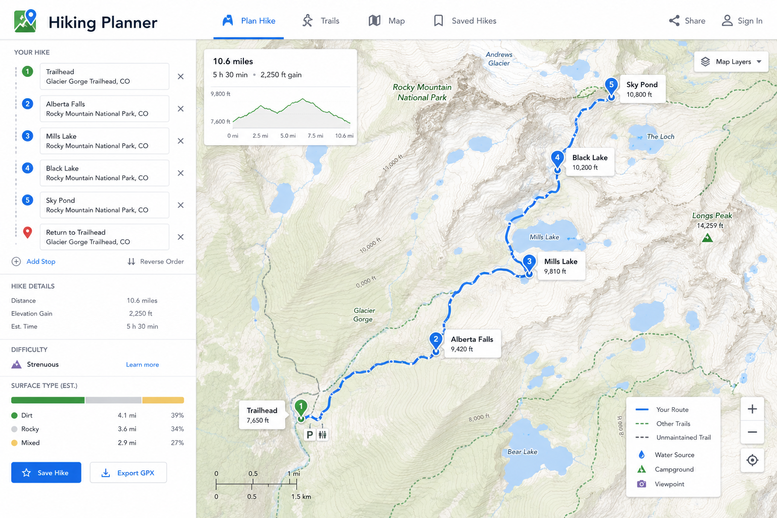
Trail maps also help identify junctions, water sources, viewpoints, shelters, parking areas and emergency exit routes. The goal is to understand the trail before conditions become difficult.
What to Check on a Trail Map
- Total distance and expected hiking time.
- Elevation gain, steep sections and trail surface.
- Trail junctions, markers and turnaround points.
- Water availability, shade and exposed areas.
- Parking, trailhead access and backup routes.
Planning Hiking Time and Difficulty
Distance alone does not show difficulty. Elevation gain, altitude, heat, snow, mud, stream crossings and pack weight can all slow the hike. Build in extra time for breaks, photos, route checks and changing conditions.
Choose a trail that matches the group. A route that is easy for one person may be too long, steep or exposed for another. Turnaround times are useful because they prevent finishing after dark.
Hiking Safety and Navigation
Carry navigation backup even when using a phone. Offline maps, a charged battery, a paper map or a GPS device can help if signal disappears. Tell someone your planned route and expected return window.
Pack water, food, layers, first aid, lighting and sun protection. If the weather changes or the trail becomes unsafe, turning around is a successful planning decision, not a failure.
Frequently Asked Questions About Hiking Planner
What is a hiking planner?
A hiking planner helps organize trail route, distance, elevation, timing, gear, weather and safety details before a hike.
Is hiking distance enough to judge difficulty?
No. Elevation gain, trail surface, weather, altitude and pack weight also affect hiking difficulty.
Should I use offline maps for hiking?
Yes. Offline maps are important because many trails have weak or no mobile service.
What should I do if a hike takes longer than expected?
Use a planned turnaround time, monitor daylight and conditions, and turn back early if needed.